
IMD warns western disturbance may trigger rain, thunderstorms and gusty winds.
Delhi temperatures to dip as wet spell likely between January 22–24.
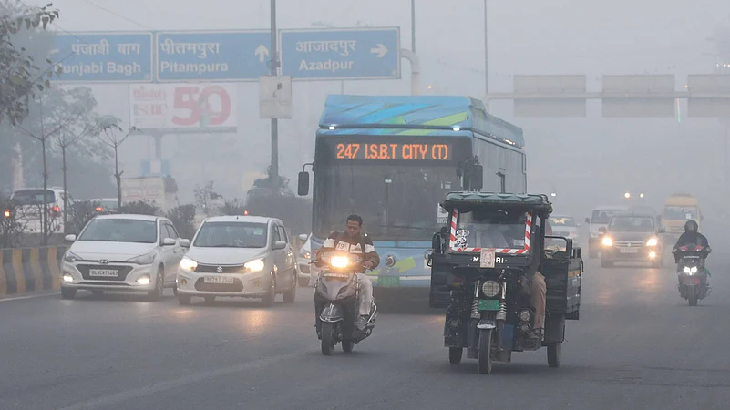
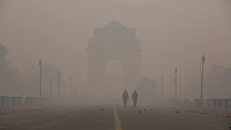
Smog persists with AQI in very poor category despite marginal improvement.
Delhi is expected to experience more chilly winter days intense Western disturbance is likely to impact over northwest India from the night of January 21, according to the India Meteorological Department (IMD) news release. Over the next three days, the capital city is expected to experience another wet spell due to the current atmospheric conditions.
"Isolated to Scattered light to moderate rainfall likely during January 22 and 24. Thunderstorm activity accompanied with lightning and gusty winds (speed 30-40 kmph) during January 22 and 23," IMD stated in its news release. The met office also issued a yellow alert for a rainfall on January 23.

1 April 2026
Get the latest issue of Outlook Business

Partly cloudy weather conditions are expected on January 21. The maximum temperature is likely to settle between 22 to 24 degrees Celsius, while the minimum temperature is expected to remain around 6 to 8 degrees Celsius. The minimum temperatures will be near normal and the maximum temperatures will be appreciably above normal (3.1 to 5.0) over Delhi, IMD stated in its news release.

Smog Blankets City
Delhi residents woke up to a blanket of smog on the morning of January 21, however, air quality reported slight improvement and stood at 341, falling in the ‘very poor’ category, reported Mint.
Meanwhile, the average air quality index (AQI) of past 24 hours at 4 pm on January 20 remained ‘very poor’ at 378, according to Central Pollution Control Board (CPCB).
Predicting more days of ‘very poor’ AQI, Council on Energy, Environment and Water (CEEW) Programme Lead Mohammad Rafiuddin on January 20 told Mint, “Delhi's AQI has been in the 'Severe' (AQI > 400) category for the last two days. It is expected to be 'Very Poor' (AQI >300) or worse for the next two to three days due to unfavourable meteorological conditions. The average wind speed is expected to be below 10 kmph and the minimum temperature between 6 and 8 degrees Celsius.”
Western Disturbance Explained
Western disturbances are eastward-moving weather systems that originate over the Mediterranean region and are crucial in determining the winter weather in northern India, according to the IMD.
These systems frequently cause rainfall, thunderstorms, fog and a drop in temperature throughout the Indo-Gangetic plains when they interact with local atmospheric conditions and moist winds.
According to IMD and the Ministry of Earth Sciences (MoES), these disruptions can temporarily improve air quality by dispersing pollutants, but they can also worsen fog and smog episodes by increasing humidity. Each winter, their frequency and intensity change, affecting visibility, daily temperature fluctuations, and cold waves.