
India is rapidly integrating satellite-based Earth Observation systems into agriculture, led by a $145 million PixxelSpace consortium building the country’s first indigenous commercial EO constellation.
Space-tech startups; such as Pixxel, SatSure, GalaxEye, Dhruva Space, and SatLeo are reshaping crop monitoring, weather forecasting, and precision farming through advanced imaging, data analytics, and AI.
Despite strong government support and technological progress, the biggest challenge remains delivering space-derived insights to small farmers through local authorities, agri-businesses, and government schemes.
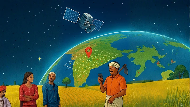
From 800 kilometers above Earth, satellites are transforming how India feeds its people. A consortium, led by satellite imaging provider PixxelSpace India Pvt Ltd, recently secured a $145 million contract to build India's first commercial Earth Observation Satellite System—a 12-satellite network designed not for defense or telecommunications, but primarily for precision farming. It is only the latest signal that India's emerging space-tech industry is betting its future on agriculture.
The reason for the focus is not far to seek. Agriculture employs 55% of India's population and spans 156 million hectares across vastly different climates and soil types. Yet 86% of farmers work on fragmented plots smaller than 2 hectares—land too small for traditional monitoring methods but perfectly suited for satellite surveillance. Add India's unpredictable monsoons and the need for real-time crop health data, and space technology stops being a luxury and becomes a necessity.
Today, with rapid advances in the deep-tech sector, the country is entering a new era where space technology is reshaping Indian agriculture, making it more resilient, data-driven, and future-ready. The question is no longer whether space-tech can solve agriculture's challenges, but how quickly these solutions can reach the farmers who need them most.
The $145 Million Bet
The landmark IN-SPACe Earth Observation Public-Private Partnership programme represents a fundamental shift in how India approaches both space technology and agriculture. Under this initiative, the Pixxel-led consortium—which includes SatSure, Dhruva Space, and PierSight—will build and operate a constellation that marks India's first fully indigenous commercial Earth Observation Satellite System.
The 12-satellite network, to be developed over four to five years, will feature a sophisticated mix of capabilities: sub-meter very high-resolution imaging, wide-swath multispectral sensors, Synthetic Aperture Radar, and hyperspectral satellites. According to Dhruva Space, this combination will enable applications ranging from precision agriculture and water quality monitoring to land-use mapping and environmental compliance.
Crucially, the project aims to reduce India's dependence on foreign imagery while ensuring that all satellites are manufactured domestically and launched on Indian rockets. It's a statement of technological sovereignty with agriculture at its core.
Why Agriculture Needs a Space Upgrade
Despite rapid economic progress in recent years, India remains a largely agrarian country, and true progress cannot be achieved without agricultural modernization.
India's agriculture market stands at around $390 billion and is projected to reach $473.72 billion by 2029, growing at 4.9% annually.
Beyond market value, the sector remains the nation's backbone—providing employment to 55% of the population, supporting allied industries, and feeding the world's largest population.
At the same time, it is a sector that needs close monitoring and policy support, which inturn creates a dependency on reliable data.
This is partly because it is heavily dependent on the monsoon: A single season of delayed rainfall can thrown an entire year's agricultural output into disarray.
Hence, predictive analytics and early-warning systems become critical, and help farmers anticipate weather shocks and respond proactively.
However, given the extremely fragmented nature of landholdings, crop surveys by state governments currently cost thousands of crores of rupees.
This is where space technology comes in. Prateep Basu, CEO and Founder of SatSure, points out that such surveys can now be done using satellite data at a fraction of the cost.
Earth Observation satellites capture high-resolution images and generate critical data that track crop health, detect pests and diseases, estimate yields, and monitor soil and water conditions. The same satellite-derived information supports everything from accurate rainfall forecasting to auto-steering tractors for precise sowing.
"There's a huge gap between manual processes and satellite-based processes," Basu explains. "Even drones, which are useful for precision applications such as variable-rate irrigation or pesticide spraying, cannot cover an entire state on a weekly basis to collect imagery. It's simply too expensive."
The second reason, as pointed out by Pranit Mehta, Co-founder of GalaxEye, stems from agriculture's status as a critical economic pillar. Over the years, ISRO has actively promoted satellite-based applications in agriculture, especially within government programmes and increasingly in the commercial sector.
"As a result, agriculture has naturally emerged as one of the most accessible and ready markets for space-tech startups in the country," Mehta says.
GalaxEye is building Mission Drishti, the world's first satellite to combine Synthetic Aperture Radar with optical multispectral imaging on a single platform. This innovation promises high-resolution, all-weather imagery crucial for agriculture, which often faces visibility challenges due to clouds or rain.
"This technology directly addresses the limitations of traditional optical satellites, providing consistent, reliable imagery that's analytics-ready regardless of weather or time of day," Mehta notes.

1 June 2026
Get the latest issue of Outlook Business


A Burgeoning Sector
India's space-tech startup ecosystem remains nascent but is expanding rapidly. Currently, 191 space-tech startups operate in the country, with around 21 focusing specifically on satellite imaging, crop analytics, and weather observation solutions—all with direct agricultural applications.
According to Tracxn data, total disclosed funding in this sector stands at approximately $102.9 million. Pixxel leads with nearly $96 million raised from marquee investors including Google, Lightspeed India, and Blume Ventures. SatSure has secured $27.07 million from backers like the Asian Development Bank and Kotak Mahindra Bank. GalaxEye follows with $13.99 million from investors including Zerodha and Infosys. Dhruva Space has raised around $16.1 million from Indian Angel Network, Blue Ashva Capital, and over 145 other investors.
The startups differentiate themselves through the specific types of data they generate and the agricultural problems they solve.
Shravan Bhati, founder of SatLeo Space Tech, exemplifies this approach. Fifteen years ago, while working on an agritech project, he noticed that publicly available data lacked accuracy. He identified an opportunity: thermal data could solve ground-level agricultural problems with deeper, richer insights.
SatLeo uses satellite-based thermal cameras to detect heat and temperature variations on Earth. The data helps farmers identify which field areas are hotter or cooler, understand irrigation requirements, and spot early signs of crop stress—since stressed plants show temperature changes detectable through thermal imaging.
Government Support as Catalyst
Government policy has been instrumental in driving space-tech startup growth. Since its establishment in 1969, ISRO has promoted satellite-based applications across sectors.
Platforms like the Bhuvan Portal—a national geo-portal providing thematic maps and datasets on land use, water resources, and disaster management—offer much of their data free of cost. The Bhoonidhi Portal, operated by the National Remote Sensing Centre, provides access to extensive remote-sensing data archives from Indian and international satellites for research, academic, and commercial use.
By making high-quality satellite data freely accessible, these platforms significantly reduce cost barriers for researchers, universities, and private startups, enabling wider experimentation and innovation.
The Department of Agriculture, Cooperation and Farmers Welfare established the Mahalanobis National Crop Forecast Centre in 2012 to operationalize space technology developed by ISRO for crop production forecasting.
The department uses space technology for various programmes including FASAL (Forecasting Agricultural Output using Space, Agro-meteorology and Land-based Observations), CHAMAN (Coordinated programme on Horticulture Assessment and Management using geoiNformatics), and NADAMS (National Agricultural Drought Assessment and Monitoring System).
During 2019-20, pilot studies were conducted across 64 districts in 15 states for 9 crops, with validation in 15 blocks across 6 states during Rabi 2019-20.

The Last-Mile Challenge
Despite this progress, challenges remain. A small farmer with limited landholding is unlikely to directly use or interpret complex satellite-generated data. According to Basu, the farmer isn't the end-customer of satellite-based data, such as crop health, crop area, crop classification and even disease detection.
"This information is used by those who serve farmers—whether government agencies providing advisories, insurance companies, banks, agri-businesses supplying seeds and fertilizers, or companies involved in contract farming," he notes.
Hence, it is up to Government authorities to ensure that data and insights reach last-mile farmers working in their fields. Making these tools widely accessible can help improve yields and returns, transforming farming from what's often seen as a backward economic activity into an advanced, value-generating sector powered by space technology.
The Opportunity Ahead
According to Market Research Future, an India-based data analysis firm, the global space agriculture market will reach $11.51 billion by 2032, up from $4.99 billion in 2023. Agriculture's emergence as a major focus area for Indian space-tech startups makes strategic sense—it offers strong, steady demand and multiple revenue-generating use cases for companies to build and scale their solutions.
"Agriculture contributes nearly 18% of the country's GDP and nearly half of India's population depends on agriculture," says Govindarajan D S, space-tech advisor and investor. "Spacetech plays a very important role in supporting smart agriculture and weather monitoring in India. Indian startups are creating a sustainable ecosystem in the form of building a constellation of hyperspectral imaging satellites, multi-sensor imagery payloads, launch vehicles, ground infrastructure, data analytics, and AI tools."
Beyond collaborating with central agencies, these startups can unlock far greater impact by working directly with local authorities on the ground. Such partnerships not only help them scale sustainably but also ensure that farmers—the real end-users—benefit directly. This grassroots integration can accelerate adoption, improve livelihoods, and expand market reach in meaningful ways.
The technology is ready. The challenge now is bridging the 800-kilometer gap between space-based insights and the farmers who need them—turning data into better harvests, and innovation into impact.