
Tropical Storm Imelda lashes Bahamas, predicted to curve away from US East Coast.
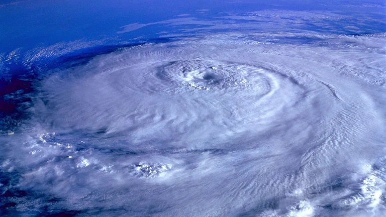
Hurricane Humberto remains Category 4 near Bermuda, potential tropical storm conditions expected.
Fujiwhara effect may occur, altering storm paths and creating unpredictable weather patterns.
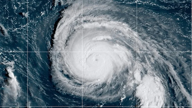
Tropical Storm Imelda formed on September 28 and is predicted to become a hurricane on a forecast track curving away from the US East Coast early this week. The storm lashed rain and churned up seas near the Bahamas and Cuba and even briefly prompted a tropical storm watch on a stretch of Florida’s Atlantic coast, reported Associated Press.
Meanwhile, Hurricane Humberto weakened slightly but remained a powerful Category 4 storm further out in the Atlantic, potentially threatening Bermuda. The Bermuda Weather Service issued a tropical storm watch, meaning tropical storm conditions were possible on the island within 48 hours.

3 February 2026
Get the latest issue of Outlook Business

According to Associated Press, Imelda was about 30 miles (45 kilometers) southeast of the northwest Bahamas and about 355 miles (570 km) southeast of Cape Canaveral in Brevard County, Florida at about 8 pm EDT, the National Hurricane Center in Miami said.
Imelda was headed north at 9 mph (15 kph), bearing top sustained winds of 40 mph (65 kph). The hurricane center said the storm was expected to move across the central and northwestern Bahamas through Sunday night and then spin east-northeast away from the southeastern US by midweek.
A tropical storm watch for the east coast of Florida from the Palm Beach-Martin County Line to the Flagler-Volusia County Line was discontinued on the afternoon of September 28. But the hurricane center urged people on the southeast US coast to monitor Imelda’s progress, reported Associated Press.
South Carolina Governor Henry McMaster also urged vigilance, although coastal Georgetown County said it was returning to normal operations because of an improving forecast for that area.
“What we learn every time is we never know where they are going to go,” McMaster said at a news conference to discuss emergency preparations. “This storm is deadly serious. Not just serious. Deadly serious.”
What’s Next
Meteorologists are observing if Imelda’s path could bring it close enough to Hurricane Humberto to trigger the Fujiwhara effect.
According to the US National Weather Service, Fujiwhara effect is a rare phenomenon where two storms orbit around a common center, either merging or merely spinning around each other briefly before shooting off on their own paths, potentially altering each other’s tracks.
Forecasts may become extremely erratic if this occurs, as the wind field and rainfall zones may change quickly. In the Atlantic basin, such interactions have only happened a few times. Because even a small shift in trajectory could result in dangerous rip currents, rough surf, or unexpected rainfall impacts, the US National Hurricane Centre has advised coastal communities to remain vigilant.