
The past two decades have seen a profound shift in the space sector. For most of the space age, high access costs limited satellites to defence, communications, weather and scientific exploration. That calculus is now changing rapidly.
Satellites have become smaller, more capable and more numerous, while reusable launch vehicles, rideshare missions, small satellite launchers, miniaturised sensors and advances in electronics have made it possible to put ever greater capability into orbit at lower cost.
'Musk’s Law', the equivalent of Moore’s Law for space, is beginning to take shape: more capability at dramatically lower cost.

1 October 2026
Get the latest issue of Outlook Business

But falling costs are only the beginning. An equally important shift is underway in how space is being used.
The focus is moving from getting into space to using space to observe, understand and ultimately govern the Earth. Two recent developments illustrate the trend.
In October 2025, Maxar, one of the world's leading commercial space companies, split into Vantor, focused on geospatial data and artificial intelligence-powered spatial intelligence, and Lanteris Space Systems, focused on building satellites and space infrastructure.
Then, in an August 2026 company address, Elon Musk said he expected AI to account for 99% of SpaceX’s value within four or five years, with Starlink potentially evolving into a platform for space-based computing and AI.
The Intelligent Shift
Different companies, different manifestations, but the same underlying trend: the space economy is shifting from hardware in orbit to the intelligence, computing and applications it enables.
While defence remains the largest user of satellite data and AI-derived intelligence, the implications extend far beyond defence. As space becomes affordable to deploy at scale, its utility expands dramatically.
More satellites mean more sensors, more data and, with AI, greater ability to understand the physical world in near real time. Space is therefore evolving from infrastructure and observation into a source of intelligence and a tool for governance.
Just as digitisation transformed government from paper-based processes to digital platforms, space is becoming an invisible layer of governance, continuously sensing the physical world and feeding low-cost, high-frequency actionable intelligence to governments.
The value proposition of space-based governance rests on three shifts. First, from periodic surveys to continuous sensing, enabling vast territories to be observed in near real time.
Second, from manual observation to AI-enabled intelligence, identifying changes, detecting anomalies and triggering targeted action. The principle shifts from inspect everywhere to observe everywhere, inspect where necessary.
The next phase could see geospatial data becoming an on-demand utility for individuals and businesses
Third, space is making previously inaccessible areas visible, measurable and economically usable, opening opportunities in precision agriculture, mineral exploration, fisheries, offshore energy and maritime logistics.
Space is, therefore, not merely helping governments see more; it is expanding the physical and economic map that can be governed, managed and productively used.
The global experience offers a glimpse of what is possible. In 2025, European Space Agency’s Φsat-2 demonstrated onboard AI for detecting wildfires, ships and marine pollution, while US space agency Nasa demonstrated an Earth-observation system that could use AI to decide autonomously what to observe from orbit.
Meanwhile, satellite mapping is opening oceans and remote areas to fisheries, maritime activity and offshore energy in 46% of US waters which remain unmapped in 2025.
India is witnessing the same transformation.
The Reforms Push
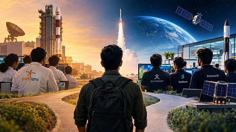
The 2020 reforms opened the space sector to private participation, while space challenges in 2022 gave the start-up ecosystem an early boost. From a handful then, India now has over 400 space start-ups.
The government’s Indian National Space Promotion and Authorisation Centre (IN-SPACe) has facilitated a 12-satellite Earth observation constellation through a ₹1,200cr public-private partnership and a ₹1,000cr venture fund. Start-ups are lowering costs by combining Indian engineering with global supply chains, commercial components and advanced manufacturing.
By January 2026, IN-SPACe had facilitated 71 Isro technology transfers, while private players had launched 18 satellites. Greater scale should further reduce launch fixed costs and bolster the competitive ecosystem.
India is also advancing data-driven space governance. Maharashtra uses satellite analytics for crop insurance across 10,000 villages, Karnataka monitors six lakh hectares of farmland and Assam uses satellite data for flood alerts in 30 districts. Rajasthan and Haryana have used satellite data to modernise land records, while Madhya Pradesh monitors 77,000sq km of forest land.
Over 70% of smart cities plan to use satellite imagery for property-tax assessment. AI is adding a new layer: spacetech start-up SatSure uses satellite-derived analytics for agricultural lending, while peer GalaxEye Blue combines satellite imagery and geospatial AI to monitor shrimp farms, assess water conditions and predict stocking and harvesting.
Growing Role of States
Perhaps the clearest sign of space-based governance becoming mainstream is the growing role of state governments. Once largely the preserve of the Centre, space is now seen by states as both an industrial opportunity and a governance tool.
Karnataka aims to capture 50% of India’s space market, support 500 start-ups and MSMEs, and enable 50 satellite missions. Kerala, Telangana and Tamil Nadu are building space ecosystems around K-Space, SpaceTech and the Kulasekarapattinam spaceport. Assam is pursuing its own state-owned Earth-observation satellite, ASSAMSAT, for applications, including agriculture, flood forecasting, infrastructure and border surveillance. Space is evolving from a national strategic capability into a distributed instrument of economic development and governance.
The next phase could see geospatial data becoming an on-demand utility for individuals and businesses.
A farmer could obtain high-resolution imagery and real-time information on soil moisture, crop health and pest activity for a specific field. A driver could receive real-time information on traffic patterns. Miners could monitor their sites remotely; logistics companies could optimise routes using continuously updated information on weather, terrain and traffic. If digital governance created a virtual representation of the physical world, space-based governance brings governance back to physical reality—providing a continuously updated, near-real-time view of the world itself.
The writer is chairman, UPSC, and former defence secretary